|
A CIRCULAR WALK OF ABOUT 3 MILES
|
MODERATELY EASY WALKING
|
|
This walk follows some of the most ancient by-ways in
Elmswell
|
 From
the Station, walk along Station Road and right into School
Road. Take the first left, Rose Lane, an unadopted road which
used to be the rail branch line linking the Station to the
brickworks at Woolpit. At the end of the lane the path meanders
to the left, well walked and easy to see, with O.C.Jewers works
on the left and Pightle Close across the field on the right.
Between the fences, the telephone exchange stands on the right,
and across Church Road to follow Footpath 16, as marked,
down Spong Lane ( a "spong" was a "drif"
or narrow spit of land). From
the Station, walk along Station Road and right into School
Road. Take the first left, Rose Lane, an unadopted road which
used to be the rail branch line linking the Station to the
brickworks at Woolpit. At the end of the lane the path meanders
to the left, well walked and easy to see, with O.C.Jewers works
on the left and Pightle Close across the field on the right.
Between the fences, the telephone exchange stands on the right,
and across Church Road to follow Footpath 16, as marked,
down Spong Lane ( a "spong" was a "drif"
or narrow spit of land).
Follow
the lane as it curves gently to the right but stop short of
the private drive and go left between the laurel hedges into
the field. See the footpath sign indicating a diagonal path
across a small field to a gap in the hedge line and continue
this diagonal line to meet with the bridge over the ditch.
Keep to the diagonal line over the third field, as indicated
by the footpath marker, to see the next marker directing you
into a small wooded area. The new wildlife area is being developed
on the right hand side of the path which takes you over a stream
and follows the boundary of the water treatment works all the
way to Kiln Lane.
Turn
left along Kiln Lane - an extremely ancient way, probably pre-historic
and cross Warren Lane, following the finger post indicating
Footpath 22. Sandy Lane, an ancient right of way which
passes between open fields and between two lone oak trees that
mark a medieval path that once crossed here but is long since
disappeared. When you reach Warren Mill House on the left,
turn left keeping the hedge and outhouse to your right to the
marker post directing you along the line of the telegraph poles
straight ahead towards Wetherden Road. This is the boundary
line between Elmswell and Wetherden and has marked important
boundaries for many hundreds of years.
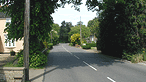
At
Wetherden Road turn right keeping to the right hand side of
the road to face the oncoming traffic for 100 yards to see
a stile on the left hand side allowing access to the set-aside
land. There is a claim currently being processed to remove
the barbed wire which prevents access to the ancient path directly
linking with the Parish Boundary path. When this is determined
there should be no need for this dangerous diversion.
Once
on the set-aside, follow the fence line to your left and keep
going over several stiles to meet the railway. Here the path
officially crosses the track but the farmer is currently working
with the Parish Council on a safer route. Stay on this side
and follow the line of the railway along the well-worn path,
up the steps and over the bridge. Continue along the track
towards the houses and into the estate following the pavement
across to a metal marker post directing you down the gravel
path between the houses and Thurlow Nunn Standen. This leads
you back to Ashfield Road: turn left and back to the Station.
|