|
A CIRCULAR WALK OF ABOUT 2 MILES
|
EASY WALKING
|
|
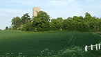
A walk mainly to the North of the railway with views
of the industrial activity that contributes so much to
the village; agriculture which remains a significant
factor in the landscape and some hint of the history
behind the railway and the airfield that did so much
to shape the development of Elmswell.
|
 Start
from the Railway Station and cross to the Flower Station car
park where a marker post directs you down Footpath 10
which follows an old railway access road serving the cattle
pens that once stood here back to the days when shunting was
done with horses. The path takes you the length of the housing
estate on the left hand side and then turns sharp left, as
directed by the marker post, to follow the field edge along
the hedge. Almost at the end of the houses the path meets a
track - Footpath 9. Turn right keeping the hedge on
our right hand side to meet another track taking you left along
the edge of Blackbourne Meadow. This is not yet officially
the footpath but negotiations are taking place to make it the
official route of Footpath 6. It takes you to the far
field edge where you turn right along the hedge to a bridge
over the ditch on the left. Start
from the Railway Station and cross to the Flower Station car
park where a marker post directs you down Footpath 10
which follows an old railway access road serving the cattle
pens that once stood here back to the days when shunting was
done with horses. The path takes you the length of the housing
estate on the left hand side and then turns sharp left, as
directed by the marker post, to follow the field edge along
the hedge. Almost at the end of the houses the path meets a
track - Footpath 9. Turn right keeping the hedge on
our right hand side to meet another track taking you left along
the edge of Blackbourne Meadow. This is not yet officially
the footpath but negotiations are taking place to make it the
official route of Footpath 6. It takes you to the far
field edge where you turn right along the hedge to a bridge
over the ditch on the left.
In
the next field keep the hedge on your left until it finishes
and then strike out straight ahead across the field, a well
defined path to the marker at another bridge. Again, in the
next field, keep the hedge to your left as you follow the field
edge. This is part of the old Ashfield Airfield: you can see
the wartime concrete remains and the industrial buildings in
the distance which now form part of the Grove Lane Industrial
Estate. As the concrete roadway curves to the right keep straight
on as indicated by the marker across the field and a broad
grass verge to join a concrete road again leading you straight
ahead to Grove Lane. Turn left on to Grove Lane. Pass the playing
field and on to Ashfield Road.
Turn
right on to Ashfield Road for some 30 yards past 'Halvasso'
to meet Footpath 3. The marker directing you left along
the broad field edge path and straight across the field to
another marker. Some may prefer to follow the field edge all
the way round to the marker. Keeping the ditch on your left,
walk on until you meet a broad grassy ride taking you sharp
left, with the Bacon Factory buildings to your right in the
distance and Thurlow Nunn Standen's radio mast directly ahead.
At the metal gates cross the stile and follow the marker arrow
taking you diagonally across the small paddock some 25 yards
to another stile. Over this and straight across the field,
joining the ditch line and with the Bacon Factory buildings
straight ahead. Over the bridge turn sharp left along the field
boundary, keeping close to the ditch until directed by the
marker to head diagonally across the field to join the factory
drive.
From
here you can head back to the Station down Ashfield Road. or
follow the path as marked over the grass below the car park
and left into the fenced section which follows the perimeter
of the factory through the industrial estate to emerge at the
railway line. Some 20 yards along the railway see the level
crossing which, crossed with due care, takes you to a path
on the other side. Turn left and follow the path into Hawk
End Lane, one of the original settlements of early Elrnswell.
Walk left along the lane to School Road and left at the Co-op
back to the Station.
|